- Jobs
 ResumeCreate your job-winning resume using our free resume builder.
 PortfolioShowcase your skills and projects with a professional portfolio.ResumeCreate your job-winning resume using our free resume builder.Resume BuilderMake a resume for free.Resume TemplatesAccess our extensive library of professional & ready-to-use templates.Resume ExamplesGet inspired by real resume examples to create your own.Occupation GuideAccess resume writing guides tailored for different professions.Resume HelpGet expert advice on all things resume from our team of recruitment specialists.
- ResourcesSuccess StoriesBusiness ExcellenceAbout CakeResumeFeatured Reads
- Hire
- Download our App


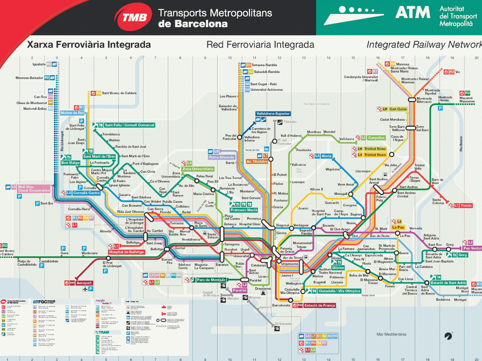
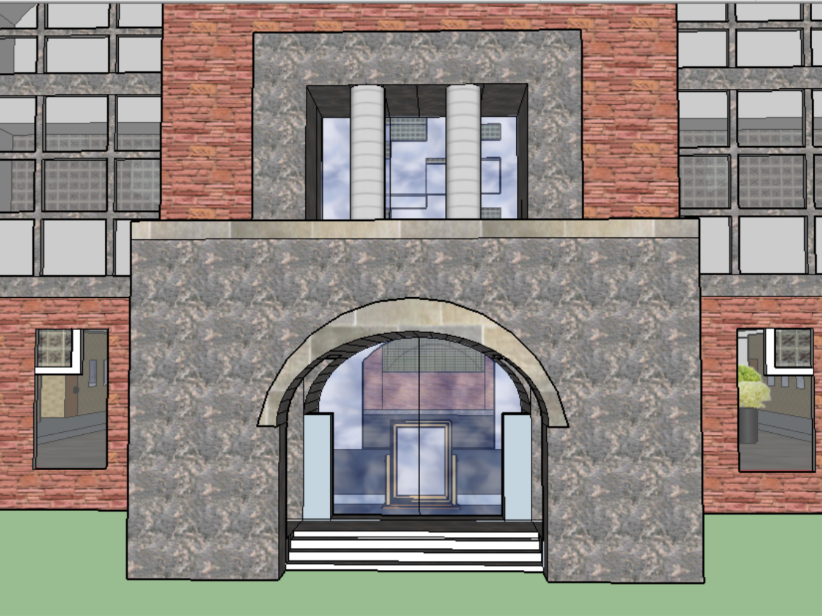
Surveying & Engineering Graphics Combined Projects

Surveying & Engineering Graphics Combined Projects
・
Taipei, Taiwan
Project 1(2D):https://ppt.cc/fply1x
Project 2(3D):https://ppt.cc/f7hRDx
-
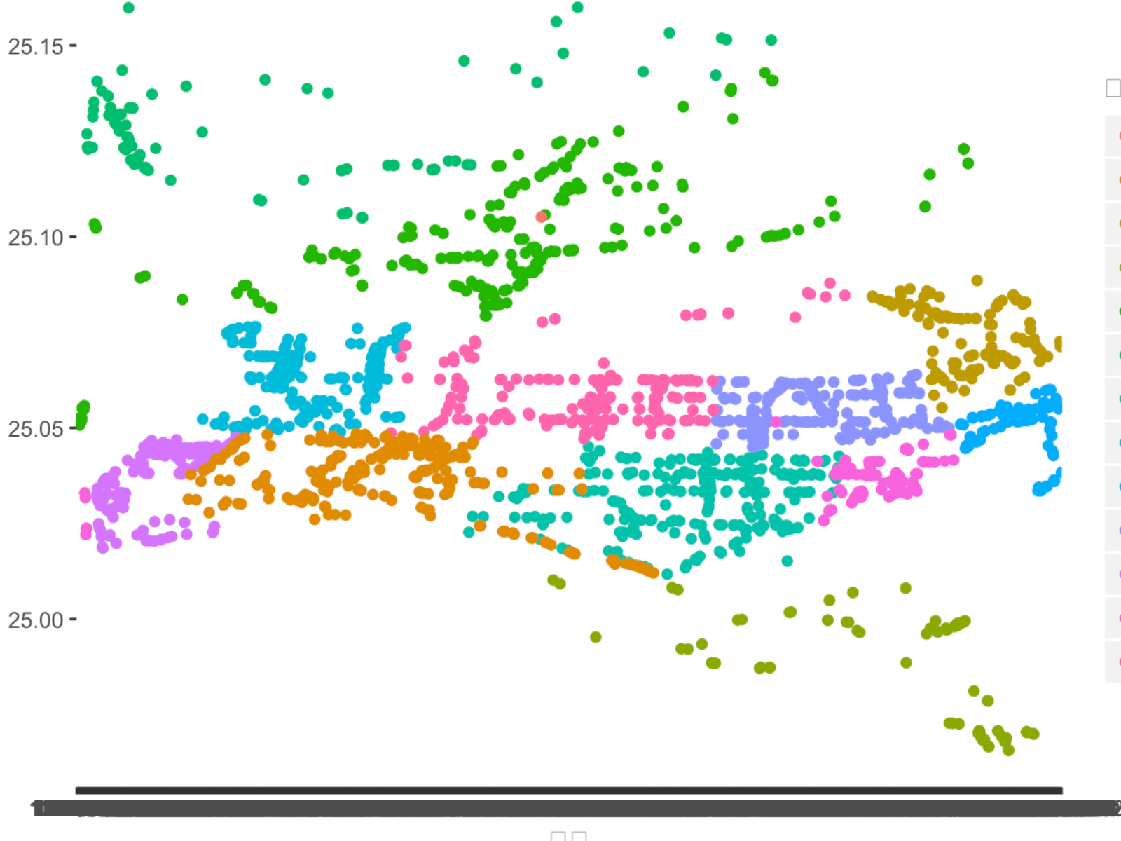
Project Goal|
In the class, we need to select one of the buildings in the campus to measure the ground control points, draw a 2D graphic and build a model. Then, the professor would combine all the projects to make a map.
-
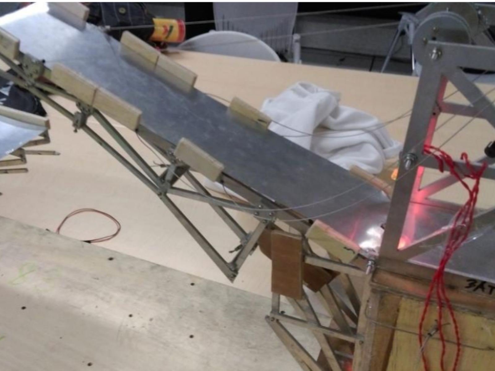
What I did|
Using total station to measure the ground control points, error correction, marking the points in AutoCad, building 3D model with SketchUp
Please login to comment.